From Unlock15
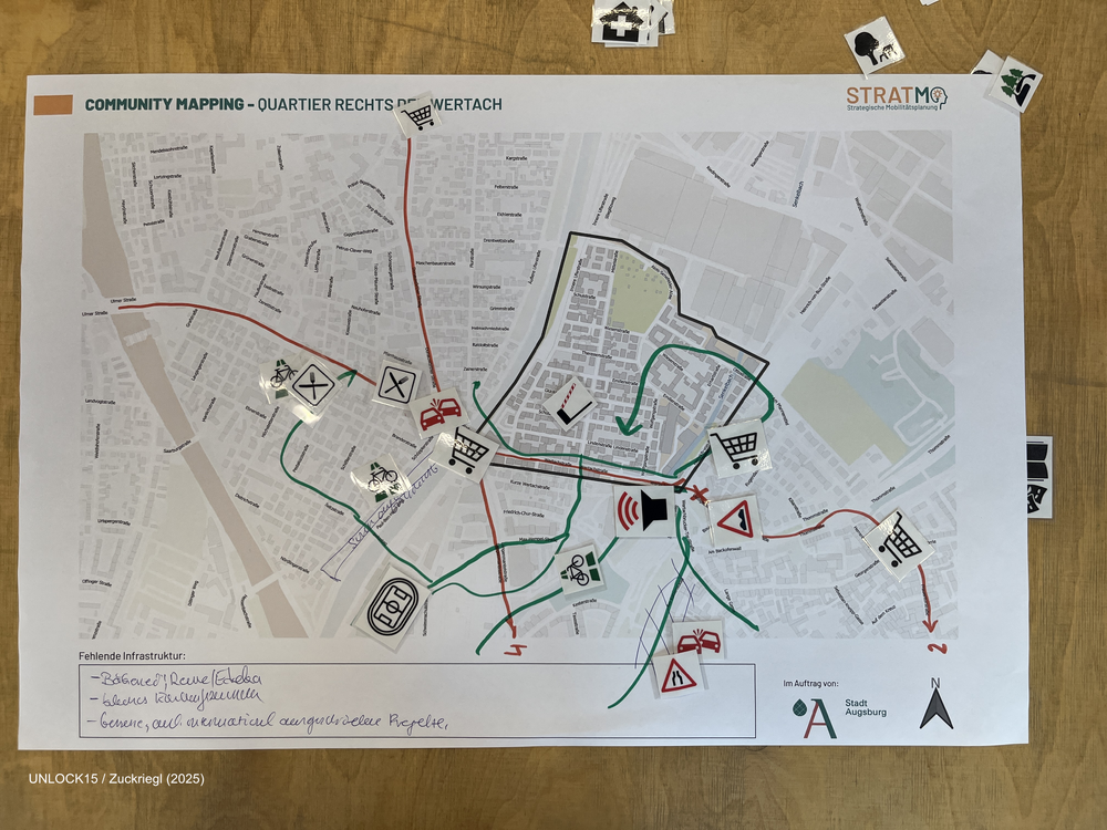
Community mapping
Collaboratively mapping maps about a neighbourhood can shed light on factors that influence everyday transport-related decisions.
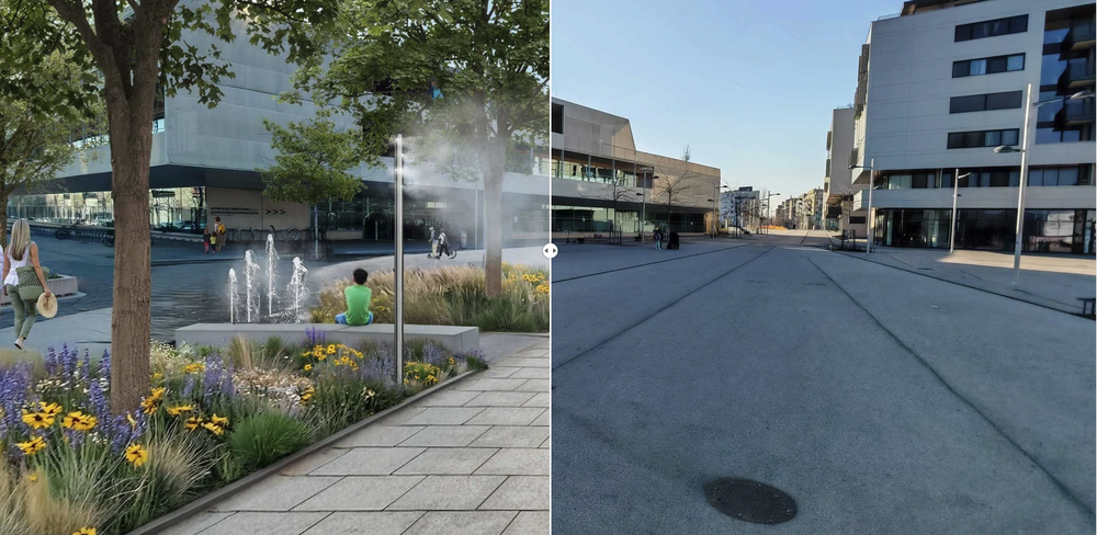
Make your city bloom! Before/After Visualization
An AI-based tool for demonstrating and visualizing street redesigns.

Regulars table for district politics and initiatives
In this format district politics and initiatives meet up in a casual setting. This benefits everyone: On the one hand politicans can efficently update several initiatives at the same time and get wind of citizens troubles related to urban space at an early stage. Initiatives on the other hand get insights and can discuss their visions and potential future collaborations.