From Unlock15
Collecting data about parking occupancy
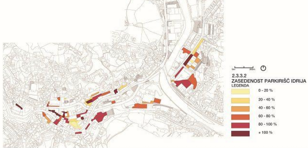
Opponents of street transformation often claim, that there are to little parking possibilities. But is that true? Evidence in Ljubljana showed that the city has rather a problem with how parking space is unevenly occupied. The urban design studio prostorož suggested the following steps to collect data about parking space occupancy.
- define the area of observation (street / block / neighbourhood)
- prepare the site plan of all the parking spots you will observe / have access to, regardless of ownership
- set a hypothesis (e.g. parking is occupied by employees, not generating income for local shops)
- create an observation plan: check occupancy one Wednesday and Saturday; and granular occupancy of observed parking lots every 2 hours, starting from 5 AM to 12:00 PM
- graphically present data for example via Q-GIS and interpret results
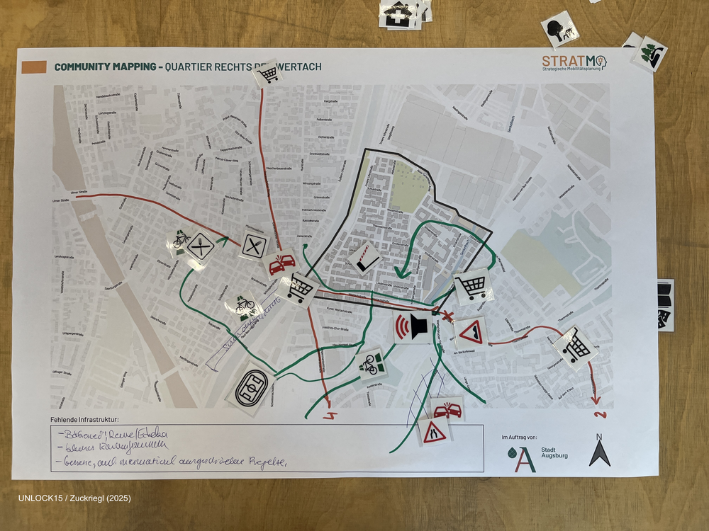
Community mapping
Collaboratively mapping maps about a neighbourhood can shed light on factors that influence everyday transport-related decisions.