From Unlock15
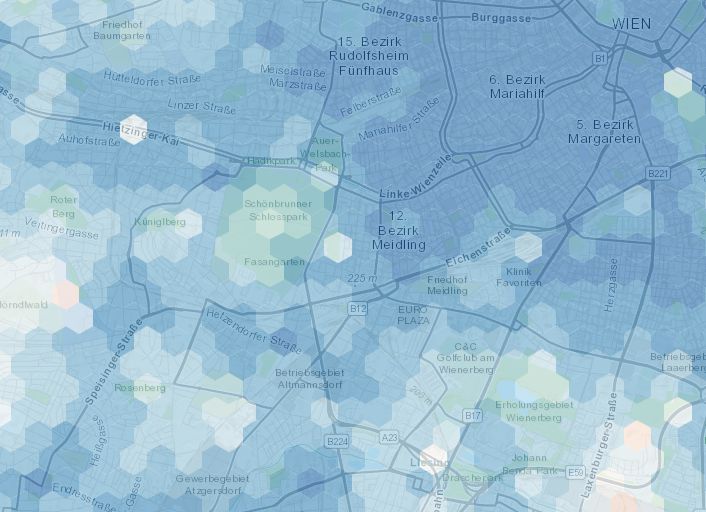
15min-City online Maps
The map shows how close services are if one lives in different areas of the city: in red areas the time needed to access the closest services is on average higher than 15 minutes, while the blue are 15-minute areas. We consider the average time of accessibility to the closest 20 POIs.
Measuring the sustainability of streets
An instrument that enables the assessment of road infrastructure projects taking into account sustainability goals.
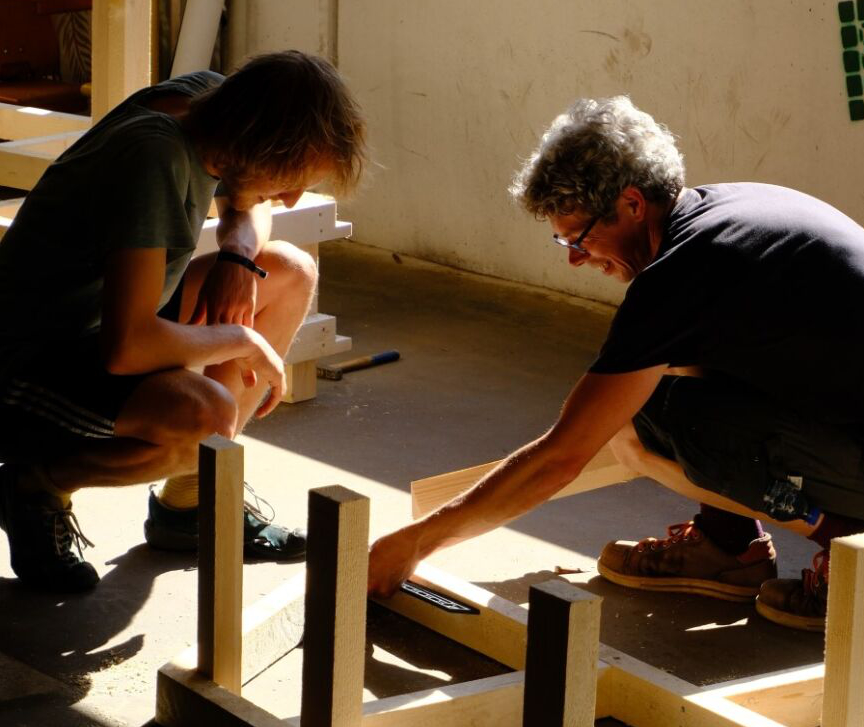
New local collaborations to boost change!
Lack of funding or stuck in slow processes? Maybe a local collaboration can boost your vision to the next level! That happened to the Galileigasse in Vienna. Thanks to a collaboration between the district Alsergund, the Technical University Vienna and the LA21 the schoolstreet was completely transformed. A team of city planning and architecture students, their teachers and one carpenter planned and built the tactical urbanism elements within one semester. The district covered the cost for the material. The project cost a fracture of what it would have cost if a team of professional carpenters had done it.
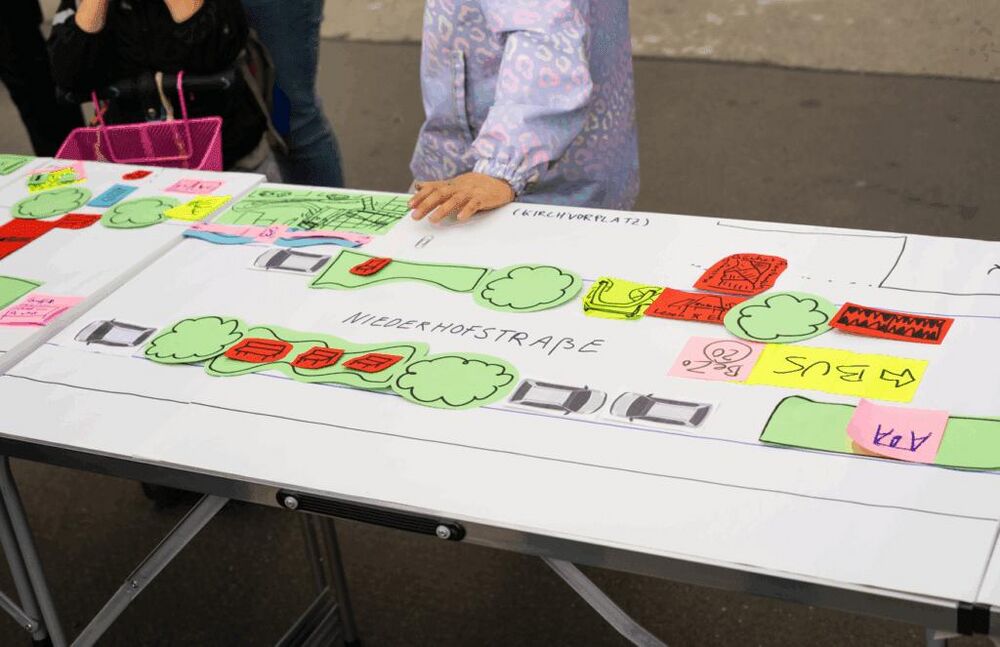
Streetdesign table
By setting up a table in the street, a big print of the layout of your street and pens you can provide a fun way to develop ideas for greening, traffic calming and street furniture. You could discuss with passers-by what uses they would like to see, what space is needed for them, and what ideas they can come up with. From a simple cycle path to a vibrant street park! If you live in Vienna, the platform WirMachenWien can assist and do the workshop with you.