Created page with "{{#semorg-list:toolbox |query=semorg-toolbox-tool-type::Vision |filter links=toolbox-language,toolbox-spatial-context,toolbox-effort-level,toolbox-lock-in-cluster |card template=toolbox |nopagination }}" |
No edit summary |
||
| Line 1: | Line 1: | ||
{{#semorg- | {{#semorg-overview:toolbox | ||
|heading={{PAGENAME}} | |||
|query=[[semorg-toolbox-tool-type::Vision]] | |query=[[semorg-toolbox-tool-type::Vision]] | ||
|filter links=toolbox-language,toolbox-spatial-context,toolbox-effort-level,toolbox-lock-in-cluster | |filter links=toolbox-language,toolbox-spatial-context,toolbox-effort-level,toolbox-lock-in-cluster | ||
Latest revision as of 12:38, 15 May 2026
Align on Your Impact Goals
Break your vision down with a Campaign plan

Building durable groups with low hierachies
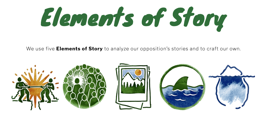
Developing a convincing story for your campaign
Efficient decision making in low hierachy settings
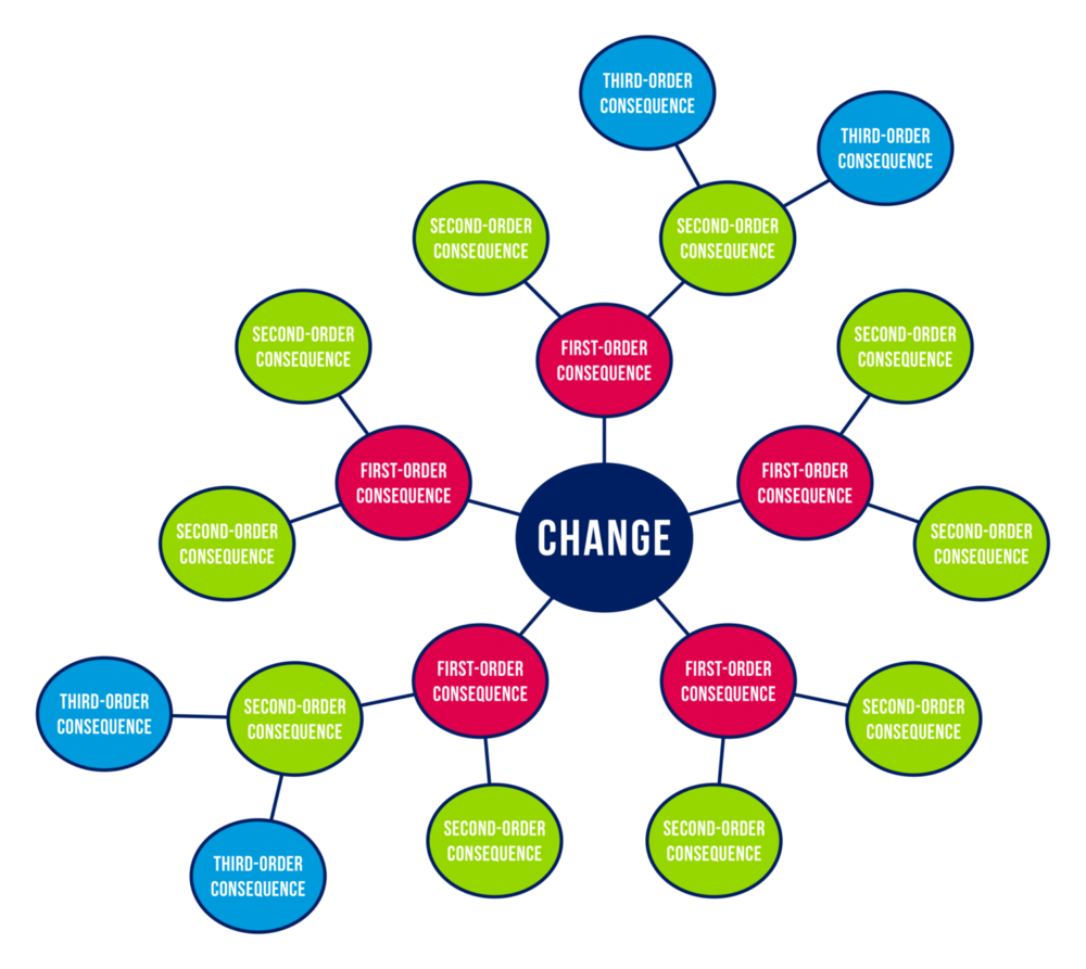
Forecasting change
The Futures Wheel is a visual foresight and brainstorming tool invented by American futurist Jerome C. Glenn in 1971, designed to graphically map the primary, secondary, and tertiary consequences of a specific event, trend, or change using a circular diagram with concentric rings radiating from a central hub.
The method works by placing a central change or issue at the core of the diagram — for example, a new policy, a social trend, or a strategic decision — and then working outward in layers. The first ring captures direct, first-order consequences; from each of those, a second ring of second-order consequences is generated, and so on — surfacing implications beyond the immediate and obvious, and helping develop an understanding of causality through ripple effects.Getting to the core of human behaviour
Learning public participation hub

Make your city bloom! Before/After Visualization
Making processes in public administration more transparent
Newspaper of Tomorrow
Onboarding framework
The Onboarding Framework is a structured yet flexible tool designed to help grassroots civil society initiatives welcome and integrate new volunteers with as little friction as possible.
The framework helps initiatives answer three core questions: What does a new volunteer need to know, feel, and do to get started? Where do their skills and interests fit best? And how can the organization make that first step feel easy, welcoming, and worthwhile?
By providing a clear path from curiosity to commitment, the Onboarding Framework reduces dropout at the earliest stage, builds a sense of belonging from day one, and ensures that volunteer energy is channeled effectively — strengthening the initiative's capacity from the bottom up.
Plenary for Emotions
A plenary for emotions is a structured group format that creates dedicated space for emotions and interpersonal dynamics within a collective or initiative — separate from task-oriented or decision-making meetings. Rather than pushing emotions to the margins of group life, the Emo-Plenum treats them as essential information: a signal about the health, motivation, and tensions within the group.
It is recommended to have a person that facilitates the plenary. This means guiding through the structure and keeping an eye on the time. This is how a Plenary of Emotions can be structured:
- Round: Each person expresses how they feel. In regards to the group but also in general. Resist the temptation to react to what has already been said and focus on yourself. The round is finished when everybody has shared something.
- Round: In the same order as before people can react to what has been said by others. The focus lies on validating and relating to emotions of others not jumping into problem solving mode right away. The round can go as long as people have to say something.
- Round: Collect next steps from what has been said. This can happen but doesn't have to.
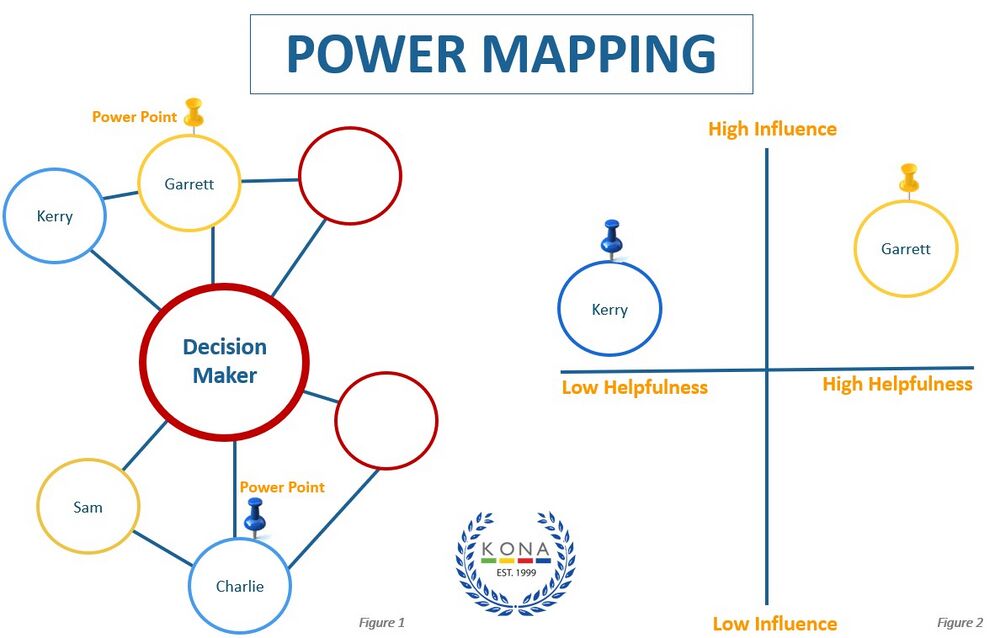
Power Mapping
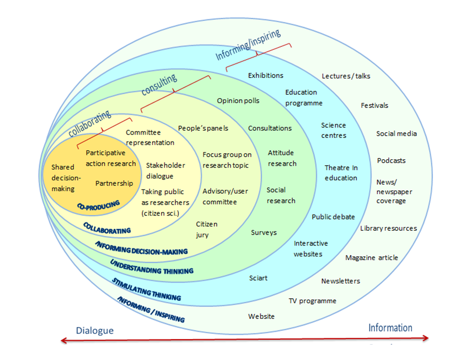
Public Engagement Onion
The Public Engagement Onion is a visual framework originally developed by the Wellcome Trust that maps the different levels and forms of public engagement — from broad, one-directional communication to deep, two-way collaboration.
Like the layers of an onion, the model moves from the outside in: the outer layers represent activities such as broadcasting information or raising awareness, where the engagement is relatively wide-reaching but shallow. Moving toward the center, activities become more interactive and participatory, culminating in shared decision-making and co-creation at the core.Task & Maintenance: What Makes Groups Work?
Tools to help communicate within a group