Welcome to the UNLOCK15-Toolbox - we are collecting tools to empower „agents of change“ from civil society as well as city officials to unlock existing lock-ins. We hope you will find some relevant tools to drive change towards mobility transition in your context!
From experience, three types of tools are need for real change: tools to create and communicate evidence, tools to envision possible futures and scenarios and participatory tools for on-site action.
This type of tools help you to collect evidence, which supports the change you are aiming for. Some tools also allow crowd-based approaches to involve citizens in a broad manner. Evidence helps to convince decision makers to back-up change.
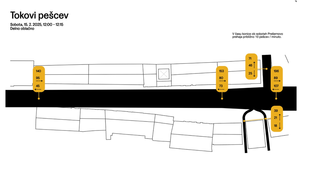
Collecting data on how people use space can give you a solid foundation to discuss how it should be designed. The free public live app helps you to collect the data you need when observing people. The second link leads you to a website where you can download an analog version with excel sheets. The picture is an example how you could visualise the collected data, done by urban design studio prostorož.
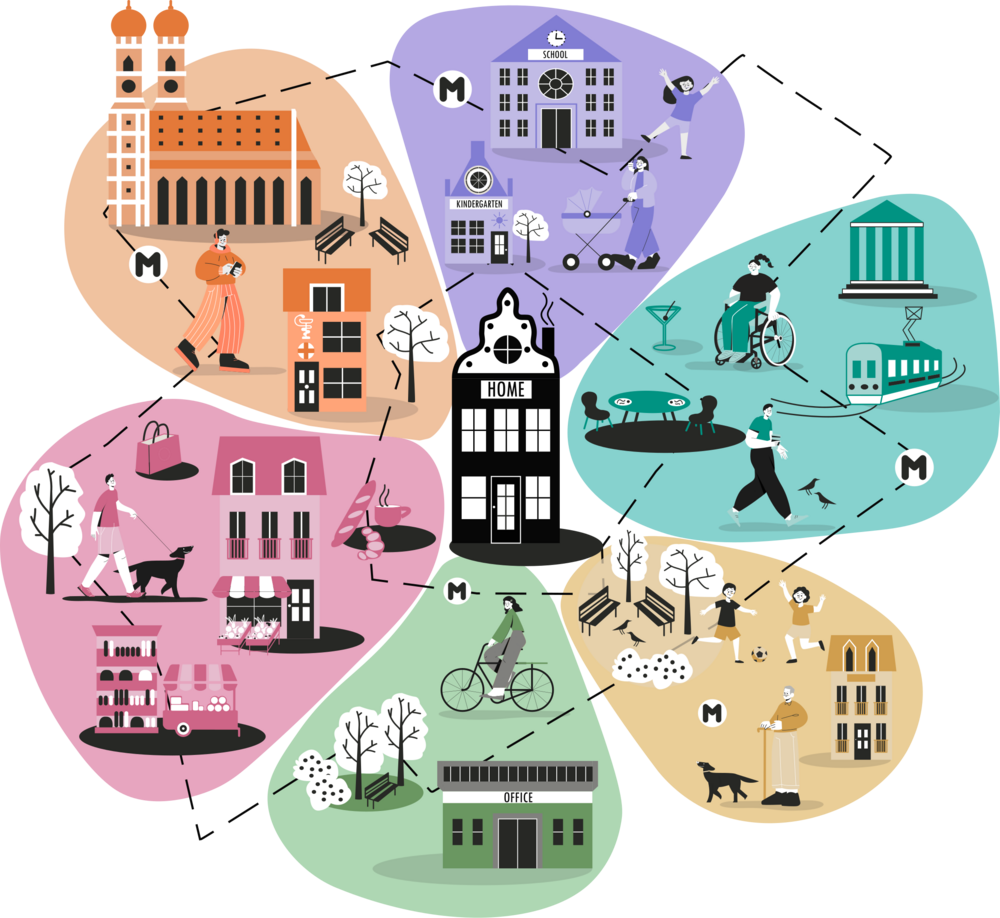
The flowers are a planning tool that invites participants to look beyond their current travel routines by imagining instead how they would like to get around. This perspective grounds accessibility planning in people's needs and desires, helping make cities more livable, sustainable, and fair.
A joint survey between district politics and initiatives has potential to drive change. A survey means to ask inhabitants of an area what they like or don't like about status quo and what they want to change. The initiative has local knowledge of the area and knows what is important to ask. The survey results give politicans guidance what kind of change is backed up by the inhabitants.
From our experience a joint survey is possible when
- all involved people are amicable towards each other
- there is a third neutral party (for example science project or neighbourhood management) that coordinates the process
more tools for Evidence…
In this category you find tools that help you to create a vision of what you are aiming for. A strong vision is key for driving change because it helps you to grow as a movement and to shift public opinions. This category also includes tools that help you envision how you want to work together as a group.

Capture the shared purpose, values and behaviours of a team with this template from mobilisation Lab. This helps to build an environment in which everybody feels safe and motivated.

Defining goals, structures, roles and means of decision making are all crucial parts of founding and maintaining collectives, cooperatives, and other groups. Many aspects of organisation however remain ad hoc, informal and opaque, creating the possibility of power imbalances, misunderstandings and exclusion. The link will lead you to website with key questions that any group should consider and define during its formation.
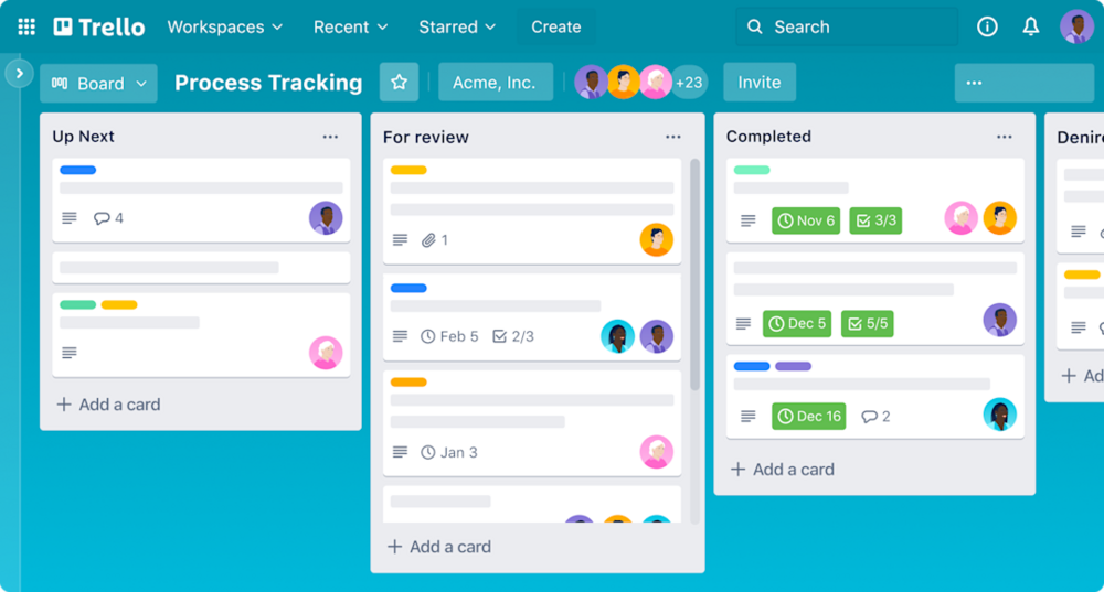
There are several digital to do lists out there, that can help you as a group to organise projects, assign tasks, set deadlines, and track progress collaboratively. Trello is free until ten collaborators, wekan and kanboard are completely open source.
more tools for Vision…
Small steps towards the realisation of local change can help to make the vision tangible and also easier to be discussed. Tools for action help to make the impact of change tangible and involve local communities.
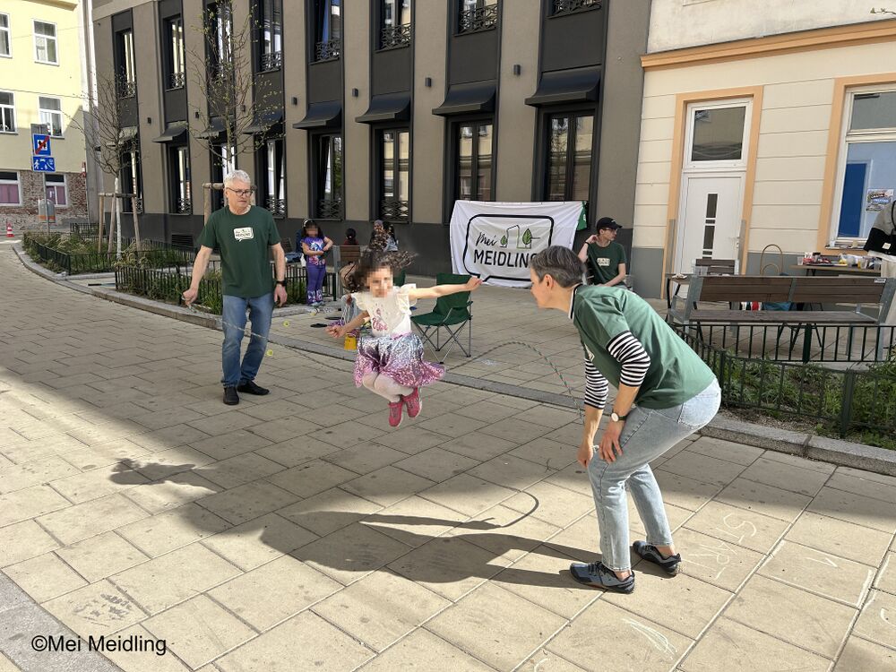
How your neighbourhood should look like should be a concern of everybody living there, right? In reality it can be hard getting in touch with people about this topic. Especially if they have a different social or cultural background than you. The initiative "MeiMeidling" faced this challenge and had a breakthrough: They blocked an alley from cars and organised street games. Especially the big skipping rope was loved by the kids. In no time the parents joined. For the first time members of the initative talked to neighbours, that were strangers to them until this moment. Knowing your neighbours does not only increase life quality but also paves the way for better communication about how this neighbourhood should look like in the future.

Tree budget Graz is an innovative financing model introduced by the City of Graz to systematically fund the planting and maintenance of urban trees. It draws from three sources: compensation fees collected under the city's tree protection ordinance (which requires replanting or financial compensation when trees are removed), voluntary tree sponsorships open to individuals and companies, and project-specific budget approvals by the city council. Together, these streams create a dedicated financial pool that ensures greening efforts are not dependent on a single, uncertain budget line.
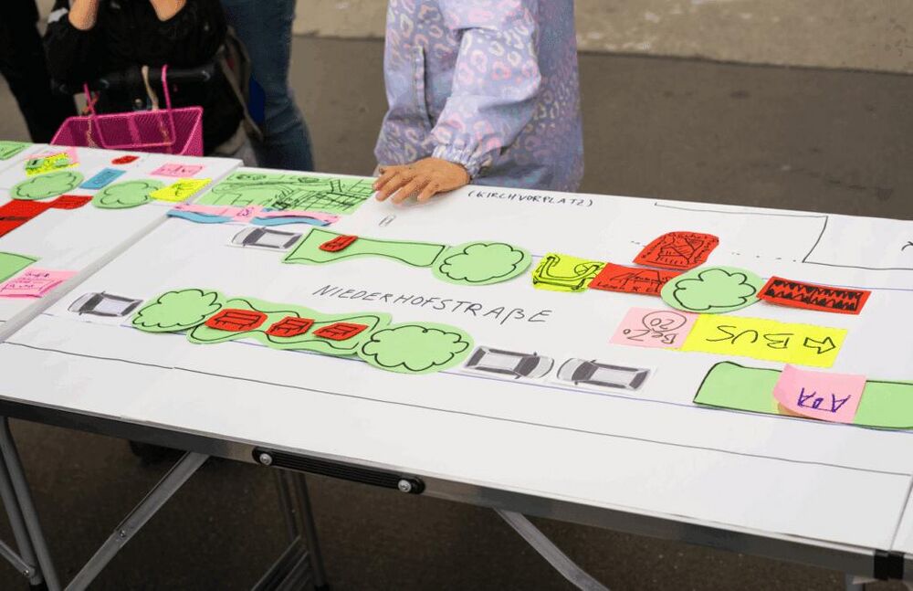
By setting up a table in the street, a big print of the layout of your street and pens you can provide a fun way to develop ideas for greening, traffic calming and street furniture. You could discuss with passers-by what uses they would like to see, what space is needed for them, and what ideas they can come up with. From a simple cycle path to a vibrant street park! If you live in Vienna, the platform WirMachenWien can assist and do the workshop with you.
more tools for Action…